
Research Projects
Ongoing

AUTOMATIC SHIPWRECK SITE DETECTION
Starting in 2016, the LAIR has been working with CalPoly SLO and archeologist Dr. Timmy Gambin to search for shipwrecks in side scan sonar data taken off the coast of Malta. A combination of traditional image processing techniques and convolutional neural networks is used to extract image features. These features are then used to propose sites of interest for classification or fed into a fully-connected network to identify the shipwrecks.

AUV-MAGNETOMETER SURVEYS FOR SHIPWRECKS
Starting Summer 2018, LAIR is looking to improve methods of shipwreck discovery with effective AUV-magnetometer surveys. The team has been conducting calibration and filter tests for the optimal interpretation of magnetometer data. These methods will be used in future launches to support the discovery of historical shipwrecks in Turks and Caicos.

RIVER MAPPING VIA AUTONOMOUS SURFACE VEHICLES
Starting June 2018, LAIR is collaborating with Caltech's geologists and Center for Autonomous System and Technologies (CAST) to develop methods to map rivers with ASV. This research includes creating water velocity and current profiles from acoustic doppler current profiler (ADCP), and using motion planning to navigate the ASV in turbulent river currents.
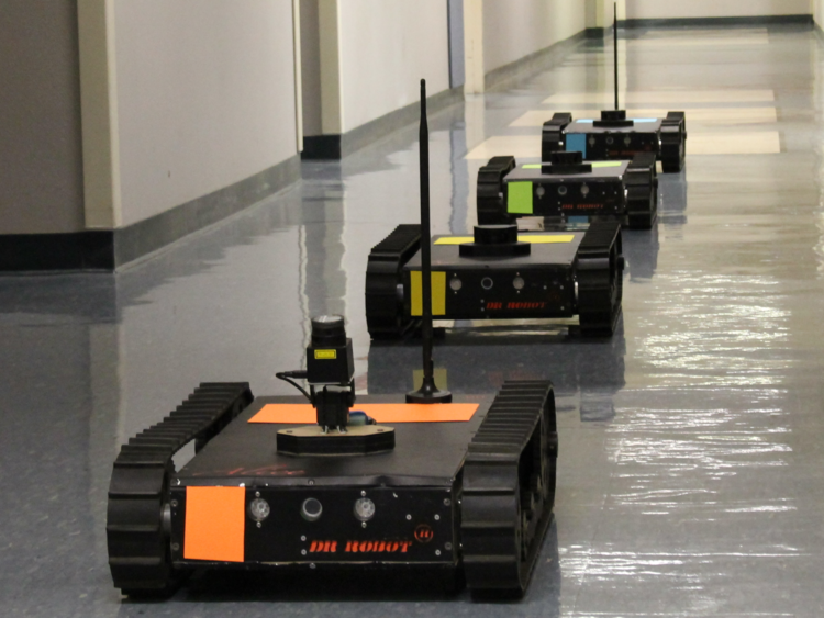
MULTI-ROBOT PLANNING IN CONFINED SPACES
Starting Spring 2017, LAIR has been using Genetic Programming (GP) to generate Multi-Robot Motion Planning (MRMP) algorithms. The generated algorithms are decentralized and local. Unlike most other MRMP algorithms, the generated algorithms do not only solve individual scenarios; the generated algorithms are general enough to solve most MRMP scenarios. We compare the performance of the GP generated MRMP algorithms to Push-Swap-Wait, another MRMP algorithm developed by LAIR.

MULTI-ROBOT POPULATION TRACKING
Starting Spring 2018, LAIR is collaborating with biologists from CSU Long Beach's Shark Lab to monitor and record video of animal population distributions using a mixed multi-robot system of ASVs and autonomous quadcopters. This research extends previous work by developing a novel controller for persistent environmental monitoring based on dynamic population distributions. Hardware trials of this system have been conducted off the coast of Catalina Island, CA.

POLLUTION MAPPING VIA MULTI-VEHICLE SENSOR NETWORKS
Starting Summer 2017, the LAIR has been collaborating with Prof. Lelia Hawkins to develop an intelligent, mobile air quality sampling platform. This project includes work on path planning for optimal information gain and pollution state estimation using a fixed rank filter.

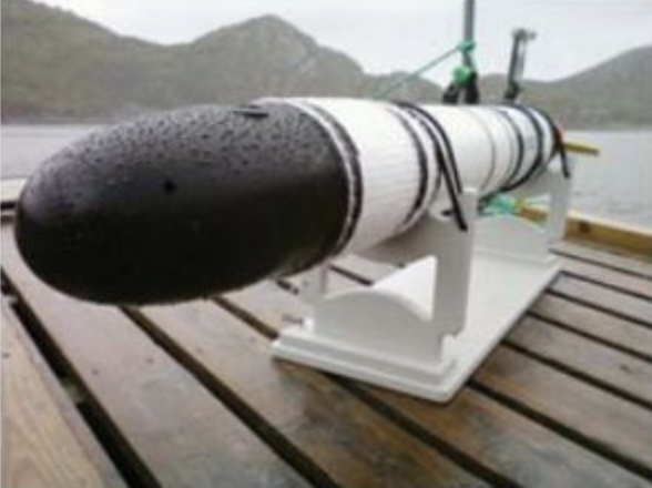
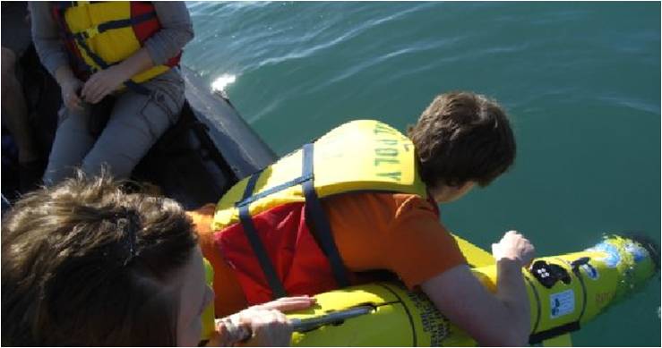
SHARK TRACKING WITH AUVS
Partnered with CSU Long Beach Shark Lab, LAIR is developing a multi-underwater robot system capable of autonomously tracking an aggregation of sharks. The system has been tested and deployed off the coast of Catalina, California and has resulted in a total of 11 publications (4 journal articles).

SHIPWRECK MAPPING
Starting Summer 2016, the LAIR has been collaborating with Cal Poly SLO and archaeologist Dr. Timmy Gambin from Malta to intelligently search and map shipwrecks using an AUV. This includes detecting shipwrecks using image processing techniques on side scan sonar data and motion-planning to map the shipwrecks.
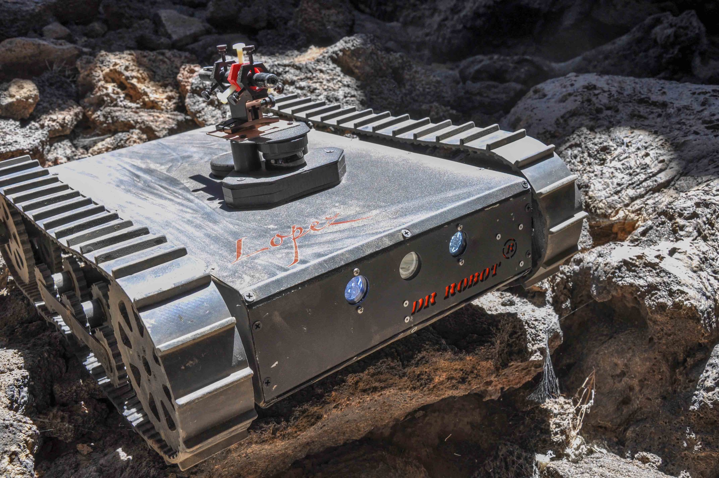
AUTONOMOUS LOADER
Starting Summer 2018, LAIR has been developing an autonomous track loader. This research aims to give the loader autonomous mapping and navigation capabilities, allowing it to traverse an unmapped area and avoid obstacles. These capabilities will be extended to accommodate moving obstacles. The system is being implemented and tested on Harvey Mudd College's campus.
Past

SHARK AGGREGATION TRACKING
Starting Fall 2015, LAIR is collaborating with biologists from the University of Saint Katherine and CSU Long Beach's Shark Lab to model and track animal aggregations using AUVs. This research extends previous work and aims to provide a novel method for tracking entire aggregations of animals using position estimates of only a subset of individuals within an aggregation.
LAVA TUBE EXPLORATION
The LAIR worked on autonomously exploring and analyzing lava tubes using a Jaguar Lite platform. Groups of robots will be deployed at a lava tube entrance to navigate the tubes, investigate interesting locations, and record data. The robots are equipped with imagers and spectrometers and utilize intelligent pattern recognition to obtain optical biosignatures of microbial life.

3D PLANNING FOR QUADROTORS
In 2014, the LAIR started a project with the end goal of localize multiple quadcopters with on board systems. This would allow quadcopters to be used as a testbench outside of their cage and increase the range of research problems that could be tested with a quadcopter.

MALTA CISTERN MAPPING
In the spring of 2008, LAIR worked with archeologist Dr. Timmy Gambin from Malta to explore and map ancient cisterns located on the islands of Malta and Gozo. A sonar-equipped Remotely Operated Vehicle (ROV) was deployed into the cisterns dating back to 300 B.C. to obtain both video footage and sonar range measurements. Different mapping and localization techniques were employed to construct 2D maps of 6 different cisterns.

ALTRUISM IN MULTI-ROBOT COMMUNITIES
As robots continue advancing and permeating our world, the frequency of interactions between robots that do not share a common goal will increase. To accomplish common goals effectively, coordination in a multi-robot community is focused on reducing robot costs. To accomplish this, robots build relationships with other robots.

NORWAY UNDERWATER SAMPLING
The ICEX Program is a collaborative effort between California Polytechnic State University's Computer Engineering Program and various international partners. ICEX is an opportunity for students to apply their technical knowledge in an international context and to increase global citizenship across campus. The 2010 program is the Norway Underwater Robot Sampling Project which has the goal of providing education and new technology to the NORUS Program.

ROV SQUID TRACKING
The Squid Tracking project is a collaboration between Pat Fidopiastis (Cal Poly Biological Sciences) and Chris Clark (Cal Poly Computer Science). In the summer of 2009, researchers travelled to shallow water beaches of Hawaii to find and track small squid using the VideoRay Pro III ROV.
AUV MISSION DATA ASSIMILATION
After obtaining several underwater parameter data sets using AUVs, LAIR began working on novel ways to integrate them into static and dynamic models. In summer of 2010, several AUV experiments were conducted in Hopavågen Bay, Norway and successfully obtained high-spatial-resolution oxygen data as well as temporal data of the bay.
NORUS
The NORUS programme Technology development for marine monitoring and ocean observation is a novel research-based higher education programme with a scientific focus on how climate-induced changes impact the living resources and ecosystems in the Arctic.

MULTI-ROBOT BOUNDARY TRACKING
This work concerns the use of a cooperative multiple robot system as applied to distributed tracking and sampling of a boundary edge. The paper introduced a new distributed controller that handles both workload and phase balancing. Simulation results were used to illustrate the effectiveness of the controller in an Autonomous Underwater Vehicle (AUV) under ice edge sampling application. Experimentation with three iRobot Creates was also conducted.

AUV TASK PLANNING
This work addresses the problem of allocating closely spaced targets to multiple autonomous underwater vehicles in the presence of constant ocean currents. The main difficultly of this problem is that the nonholonomic vehicles are constrained to move along forward paths with bounded curvatures. The proposed algorithm solves the task allocation problem with market-based auctions that minimize the total travel time to complete the mission.

AUTONOMOUS RS MEDIA
In 2008, Dr. George Bekey, Chris Clark and students enabled an RS Media with the ability to navigate autonomously.

MODULAR AND RECONFIGURABLE ROBOTS
The Waterloo Modular and Reconfigurable Robot (MRR) was designed with William Melek (Waterloo Mechanical Engineering) and students.